Wednesday, December 14, 2005

The Eagles Have Landed

They're here in Oz
You've all probably been logging onto the blog to see what's been happening...Well...I'll tell you..We've all been having a bloody good time...
We've had no internet access till now...We're all sitting on the jetty at Fraser Island ready to take the Barge to the Mainland....
This is just a quick post to let you all know that they are safe, well and having a wonderful time.
I have decided to post another blog for the trip. It's called Blackpool Rockers Downunder and to go see what Lynne, Beth, Chloe and Dan are up to...
CLICK HERE!!

Saturday, December 03, 2005

Introduction to Lynne Beth Chloe and Dan's Blog and their Aussie Trip Downunder


  • If you would like to know how to post a comment to Lynne Beth Chloe and Dan's Blog - click here.

  • G'Day...My name is Ian Kaye.
    You can see from my profile that I have been involved in tourism here in Australia for many years. I’ve had good and bad experiences within the industry but the advantage of this is....I’ve taken in the good and thrown out the bad. In other words...I think I've got it together now to be able to confidently plan and write personal itineraries to suit visitors wanting to come and have a look at what Australia really has to offer and to get what they want out of their visit.

    Lynne approached me with plans to visit Australia and after loads of backwards and forwards communication I think we have an itinerary that they are going to love.

    It ranges from some adventure to quite a lot of outdoor experiences and relaxation.

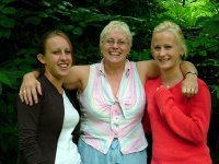
    Chloe Lynne and Beth are about to venture on a trip that's going to take them down under to wonderful places on the East and South Coast of Australia. They include places like the largest Sand Bar in the world, Fraser Island and the Whitsunday’s - Heron Island, Victoria and The Great Ocean Road, Tasmania and of course, Sydney, Blue Mountains and The Sydney Harbour Bridge Climb. In saying that, it doesn’t really spell out the wonderful scenery  and natural places in between that they will experience along the way 
    Dan
    Dan is Chloe's Boyfriend. Cool looking dude hey?
    Unfortunately, I haven't got a pic of all four of them so that will give you all a good excuse to watch this blog...There will be all sorts...

    Dan's going further on his adventures as he has applied for a working visa. Dan's a builder and will be looking for work while he is here in Australia. I have been putting out the feelers Dan and you shouldn't have any problems at all mate...Good luck and see ya soon.


    Their Itinerary

    Queensland


  • Fraser Island
  • Heron Island
  • The Bundaberg Rum Factory
  • Opals Down Under
  • The Ettamogah Pub


  • Victoria


  • Victoria
  • Great Ocean Road
  • The Otway Coast
  • The Twelve Apostles
  • Apollo Ba


  • Tasmania


    Lynne and family will be staying with relatives who are based in Launceston which is where I have been residing while in Tasmania. There are many places to visit here in Tasmania and it is a destination in itself. My advice for here is to go to the main Tasmanian Tourism Site, link below but further down the blog I have suggested a few places which I think are well worth the visit.


  • Tasmania

  • New South Wales..Where it all started


  • New South Wales
  • Sydney
  • Sydney Harbour Bridge Climb
  • The Blue Mountains
  • Wild Escapes High Country Blue Mountains Eco Tour


  • Accommodation Houses - I thought I'd include these in case any one would like to contact you. 


  • Medina Executive Apartments
  • - 10th December


  • Rainbow Beach Holiday Apartments
  • - 11th December


  • King Fisher Bay Resort Hotel Rooms
  • - 12th - 14th December


  • Gladstone Country Plaza
  • - 14th December


  • Heron Island Turtle Rooms
  • - 15th - 19th December


  • Melbourne Airport Caravan Village
  • - 19th December


  • Cumberland River Caravan Park
  • - 20th December


  • Kennett River Caravan Park
  • - 21st - 23rd December


  • Medina on Crown Executive 2 Bedroom Apartment
  • - 30th December - 5th January
    Then...Back to the UK where they will be able to share there experiences with all at home and planning either their next trip Downunder or filling in Immigration forms...Hey Guys?

    On the 10th of December at around 10pm Oz time, I will be waiting four 4 people to walk out of immigration at Brisbane International Airport. I can't wait to see the look on there faces...

    CYA Soon guys...

    2 more sleeps.

    Ian

    Wednesday, May 25, 2005

    Your Flight Details 9th December 2005 - 5th January 2006


    ROYAL BRUNEI AIRLINES
    Outbound: United Kingdom via Brunei to Brisbane Australia

    Airport Name: Seri Begawan Brunei
    Airport Code: BWN
    Country: Brunei Darussalam
    Country Code: BN
    GMT Offset: - 8.0
    Friday 09th Dec 2005
    Flight BI 98 from London Heathrow to Brunei
    Depart London Heathrow at 10:10
    Arrive into Brunei at 10:35 next day (Brunei Time) - 8 hours

    Saturday 10th Dec 2005
    Flight BI 71 from Brunei to Brisbane
    Depart Brunei at 13:00
    Arrive into Brisbane at 21:45 10th Dec 2005

    Inbound: Sydney Australia via Brunei to United Kingdom

    Thursday 05th Jan 2006
    Flight BI 194 Sydney to Brunei
    Depart Sydney at 12:50
    Arrive into Brunei at 17.15 05th Jan 2006

    Thursday 05th Jan 2006
    Flight BI 97 from Brunei to London Heathrow
    Depart Brunei at 20:15
    Arrive into London Heathrow at 06:40 on 06th Jan 2006

    The Economy Seats

    Domestic Flight Details with Qantas and Virgin Blue


    Gladstone - Brisbane               19th December         QF 2307          
    Dep - 17:35                               Arr - 18.45
    Brisbane  -Melbourne             19th December          DJ 344 
    Dep - 20.35                               Arr - 23.55
    Melbourne  - Launceston         23rd December         DJ 610
    Dep - 19.50                               Arr - 20.50
    Launceston  -Sydney                30th December          DJ 975        
    Dep - 10.00                               Arr - 11.35

    On the day of the 10th December I will be arriving into Brisbane from Melbourne on the following flight:

    10th December DJ 311 Melbourne Brisbane 08.00 09.05

    I will then transfer to 4WD Hire Service and collect your 4WD. It's at this stage that I will also stock and supply the vehicle for your adventure onto the Cooloola Coast and then onto Fraser Island.
    I will then collect you at Brisbane Airport on the 10th December and transfer you to the Medina Executive for your first night in Oz.

    I will then depart Brisbane on the following flight to meet you in Melbourne on arrival.

    19th December DJ 324 Brisbane Melbourne 12.15 15.13

    Check in time for Australian domestic airlines is at least 1 hour prior to departure.


  • You are flying on a Boeing 767-300ER on the day. If you click on this link it will take you to a similar seating plan to your Royal Brunei flight and it will give you some idea of what seats to request.


  • Royal Brunei Web Site
  • Tuesday, May 24, 2005

    Saturday 10th December 2005 - Brisbane By Day

    Day One: 10th December 2005 Arrive into Brisbane
    You'll arrive into Brisbane International Airport at around 21:45 on flight BI 71. I will have already collected your 4WD and will be at Brisbane International Airport and ready to transfer you to your accommodation at the Medina Executive Apartments in Brisbane. You will probably be weary from the flight but if not, we may be able to have a quick run around Brissy as the locals refer to it as. That can be decided on the day. Your Hotel is situated on the Eastern side of Brisbane and you should have great views of either the city or the river side. The Hotel has a pool and your room will have a balcony so you will be able to sit and relax on a typically warm Brisbane night.
    Weather in Brisbane is comfortable and sub-tropical. The city of Brisbane enjoys a very enviable climate of brilliant hot summers and clear mild winters. These enticing attributes ensure that Brisbane is idyllic for visitors all year round. Whilst summer maximum average temperatures generally linger around 30°C, the summer months have some extremely hot days. People with fair skin need to take care in using hats, cool clothing that protects them from the sun and sunscreen. These common sense practices are essential to enjoying Brisbane summers. The winter is mild and very pleasant. Most winter days are sunny with average temperatures of around 17°C. Average monthly rainfall over the year is around 96 millimetres. With an average of 8 hours of sun per day.
    December/January/February - Summer
    Mean temperature: 24.8° C
    Max average temperature: 29.2° C
    Min average temperature: 20.4° C
    Precipitation: averages 150.4mm a month
    Wind speed average: 10.9 km/h
    Brisbane Culture. The city of Brisbane boasts an impressive accompaniment of facilities to host the variety of cultural events that so frequently occur within the city. The huge Parklands complex adjoins the Queensland Cultural Centre which houses one of Australia's finest art galleries, the State Library, the amazing Queensland Museum, and the Queensland Performing Arts Complex.
    Brisbane History Brisbane has undergone significant shaping and defining changes through the times of the convicts, free settlement, world wars, and the emergence of the new state and now what can only be described as an almost exponential boom-time for this lucky city. The sighting and selection of Brisbane for a gaol site in 1823 was undertaken when Sydney and the New South Wales colony decided that they needed a more ‘out of the way place’ to store some of the more hard-case (loopy) convicts.
    By the 1860s Brisbane had shed its shady convict background and developed into a dynamic provincial centre, although it wasn't until the 1880s that the central business district was transformed by the construction of many fine public and commercial buildings. Which is a tribute to its now established standing as the heart of corporate Queensland. Brisbane's rapid economic growth, its favourable climate and wealth of facilities and resources have all attracted a massive wave of internal migration. The locals here call themselves Brisbanites and people who live in Queensland are referred to Australia-wide as Banana Benders due their huge production of Bananas.

    Since 1980 over half a million Australians from other states have packed up and moved to Queensland. Today, Brisbane has a population of 1.6 million and it's the largest city in Queensland and registered as Australia's most liveable city. It’s here that I call home so yep!


    Overnight: Medina Executive Apartments - Brisbane.


  • All About Brisbane
  • Monday, May 23, 2005

    Saturday 10th December 2005 - Brisbane By Night


    As suggested, After I collect you from Brisbane international Airport, I can either take you directly to the Medina Executive Apartments and give you time to freshen up before a night viewing of Brisbane or leave you at your accommodation to relax as you may not feel up to sitting in a vehicle after a long haul flight from the UK. This can be worked out on the night.


    Overnight - Medina Executive Apartments - Brisbane

    Medina - Executive Rooms

    Sunday, May 22, 2005

    Sunday 11th December 2005 - Brisbane to Rainbow Beach - 250 Kms

    Brisbane - Via Noosa and The Cooloola Coast National Park to Tewantin. Total travel distance: 250 km, Estimated travel time with Ian is approx 3 Hrs

    Brisbane weather is always quite reliable at this time of the year. Warm with a chance of warm rain...No cold rain here. I recommend departing Brisbane between 7-8am and travel towards Rainbow Beach past the Glasshouse Mountains and then via Coolum Beach, Perigian Beach, Noosa, Tewantin, and then the beach drive between Tewantin and the Cooloola Coast.

    There are several ways to get to Rainbow Beach but the route I recommend is via the above. Our first leg would be from Brisbane to the Etamogah Pub (more on the pub below) which is famous for it's weird design then onto Coolum Beach which is going to be your first view of The Pacific Ocean as you fly in at night time.

    From Coolum Beach and a quick swim if you're up for it, we will drive onto Noosa Heads past Perigian Beach which is close to my heart (Ask me why when we are there) While here, we should be able to spend an hour or so SHOPPING!! on Hastings Street for cool beach clothes and a last chance to collect any supplies (hats, sunnies suntan lotion etc) and a swim in the sea.
     
    Noosa is a beautiful place and shouldn't be missed. From Noosa Beach we will head to Tewantin and it's here where we will be doing our first ferry crossing onto the Cooloola Coast entry point.


    Just on the other side is a small pub where we will have to stop to let our tyres down to cope with the white soft sand from this point till we leave Fraser Island. It's from here that the adventure starts and depending on who would like to be the first one to drive on the beach, maybe a short straw jobbie, we'll change drivers.... Once we have entered on to the beach it's adventure from here on till you leave Fraser Island. Your 4WD will cope with everything that's we have in front of us but it may be a good idea once we have entered the beach to stop and have a brief lesson on how 4WD's work. This is important as there are some areas when the sand is vulnerable and the vehicle must be driven accordingly to save embarrassment.


    There's absolutely nothing to worry about in a situation like this except pride. You know the Aussie Sprit...Take the p*** first then help later...Hehe. There is always help around the corner but failing that, Ian will sort it out. I have special techniques for this sort of situations. It's called Digging.


    Another option we have on this day is to take a trip to the Tewantin State Forest and Forest Reserve. This would depend on how you feel after your flight and also the temperature of the day. It consists of Rainforest, open eucalypt forest and Wallum Heath
    remnants between Noosa and Cooroy which, are protected in this hilly near-coastal forest, Tewantin State Forest and Forest Reserve. Mt Tinbeerwah (265m) is a volcanic plug remaining from volcanic activity millions of years ago.

    It's located Towards Cooroy and we could stop and walk to Mt Tinbeerwah Lookout for a 360-degree view over the Noosa River system with its string of lakes, the coast and hinterland forests.


    A sealed 130m track at Mt Tinbeerwah provides a clear but uphill walk to a lookout overlooking the coast. There is also evidence of early Aboriginal occupation but the view from the top will give you a 360 degree view of where we are travelling too.
  • Sunshine Coast Home Page


  • Info on some of the places you will visit between Brisbane and   Rainbow Beach
  • Cooloola Coast

    Cooloola National Park to Fraser Island
    Cooloola National Park (56 600 ha) forms the southern portion of Great Sandy National. Stretching south from Rainbow Beach to the Noosa River at Tewantin, it provides a haven for indigenous flora and fauna.
    The Cooloola Coast has a lot to offer from 4WD Adventure, Swimming, Wildlife, Sun and Sand, or just pure relaxation. It's was our back yard for a while and Pablo and I have spent many days roaming around this whole region of which the Cooloola Coast and Fraser Island are both one small part to explore and having fun.
    The Islands diverse in its heritage and naming combined with its natural and cultural history. Then there's the settlement history and that's what you'll see when you visit today in a pristine and preserved environment.

    Coloured Sands - are enormous, impressive sandy cliffs, which can be up to 200 metres in height. Erosion has exposed a palette of as many as 72 different coloured sands which have been produced by combinations of iron oxide and leached vegetable dyes.

    Cherry Venture
    5 km north of Freshwater, along Teewah Beach, is the wreck of the Cherry Venture, a 1600-ton cargo ship sailing from New Zealand to Brisbane, which ran aground amid rough seas and disabling winds on July 8, 1973. Four years were spent trying to refloat the vessel before it was abandoned to its present fate as a curiosity upon the beach.

    Rainbow Beach was originally known as Back Beach was first gazetted in 1969 to service the thriving sand mining industry in the area.When the mines were forced to close in 1976 due to pressure from the environmentalists, tourism and fishing took over as the primary industries in the area. Rainbow Beach is a great place to stop and enjoy the evening warmth. As we will be staying there, there will be an opportunity to wander around the township, along the beach, swim at your leisure and of course. Like all Aussie and UK towns, It has a great pub. Hope you're good at pool?

    Double Island Point was named by Captain James Cook on Friday 18th of May 1770 as written in his log.
    At 2pm we made sail with the wind at SW and at daylight saw the land extending as far as N 3/4 E. The point set last night bore SW by W, distant 3 or 4 leagues. I have named it Double Island Point, on account of its figure (Lat 25 58'S, Long 206 48'W). The land within this point is of a moderate and pretty equal height, but the point itself is of such an unequal height that it looks like 2 small islands laying under the land; it likewise may be known by the white cliffs on the N. side of it.
    The Double Island Point Lighthouse was completed in 1884 and is 12 metres in height. Whales can be seen in good numbers from the point during the Whale Watching Season (July to November)The Surf at Double Island Point is a Right Hand Point Break with a length of 50 to 150 metres and on a good day can be 300 to 500 metres.
    Located a short distance off Double Island point is Wolf Rock a formation of four volcanic pinnacles and is considered to be one of the top ten Scuba Diving destinations in Australia.
    Some excellent fishing can be had either from the Beach or Rocks. As we drive up the Cooloola Coast we eventually come to the end of the beach. This is Double Island Point and its here that we have to travel through and across the point to get to the other side. If there is going to be a place where we get stuck, it will probably be here as the approach to the access is soft and very boggy. Once we have achieved this, we can take a drive to the point and climb to the top. It's here that we have usually spotted anything from Sharks, Manta Rays, Dolphins and many other varieties of marine life. From here, it's a short drive to Rainbow Beach where we will spend the night.

    Cooloola National Park to Fraser Island
    Cooloola National Park (56 600 ha) forms the southern portion of Great Sandy National. Stretching south from Rainbow Beach to the Noosa River at Tewantin, it provides a haven for indigenous flora and fauna.
    The Cooloola Coast has a lot to offer from 4WD Adventure, Swimming, Wildlife, Sun and Sand, or just pure relaxation. It's was our back yard for a while and Pablo and I have spent many days roaming around this whole region of which the Cooloola Coast and Fraser Island are both one small part to explore and having fun.
    The Islands diverse in its heritage and naming combined with its natural and cultural history. Then there's the settlement history and that's what you'll see when you visit today in a pristine and preserved environment.

    Coloured Sands - are enormous, impressive sandy cliffs, which can be up to 200 metres in height. Erosion has exposed a palette of as many as 72 different coloured sands which have been produced by combinations of iron oxide and leached vegetable dyes.

    Cherry Venture
    5 km north of Freshwater, along Teewah Beach, is the wreck of the Cherry Venture, a 1600-ton cargo ship sailing from New Zealand to Brisbane, which ran aground amid rough seas and disabling winds on July 8, 1973. Four years were spent trying to refloat the vessel before it was abandoned to its present fate as a curiosity upon the beach.
    Overnight: Rainbow Beach Holiday Village


    Cooloola Coast and Rainbow Beach

    Friday, May 20, 2005

    Monday 12th December - Rainbow Beach to Fraser Island - 80 Kms.


    Just when you thought the fun might end, yet another adventurous day. We'll depart Rainbow Beach at your leisure and drive onto the beach and head towards a place called Inskip Point. This is where the ferry crosses the water and is the access to Fraser Island and it's a 5 minute ferry crossing. Once onto Fraser Island, we will head up the main beach and stop at Eurong Resort for refreshments and lunch.

    What do you think of this as a suggested lunch???
    I would suggest maybe a BBQ. There are many free BBQ sites scattered over the Island. No need to carry a heep of $1 coins with you...That's around 30P...They're free....Don't get much for free these days. Would cost about $AUD20 (£7) for the lot of us with salad and fruit and a beer...

    After lunch, we will head up the beach a little further and leave the beach at Happy Valley stopping at Eli Creek on the way.


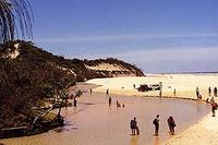
    Eli Creek
    Eli Creek is the largest freshwater streams on the eastern coast of Fraser Island.


    With over four million litres of water flowing from its mouth onto the beach and into the ocean every hour, Eli Creek is considered to be one of Fraser Island's most popular natural wonders.


    From here we will head to our accommodation house at Kingfisher Bay Resort. We'll drive through lush rainforest stopping on the way for a good look and maybe a sand blow or two. The rainforest is quite a contrast to the beach and you will be surprised.
  • Some Good reading on the Aboriginal History of Fraser Island
  • Fraser Island

    Fraser Island is the largest sand island in the world at 360 square miles. It was inscribed as a World Heritage site in 1992. Fraser Island is located off the east coast of Australia approximately 200 kilometres north of Brisbane, Queensland. With Cooloola, the island forms the Great Sandy Region, stretching 175 km north to south, varying in width up to 25km, with the highest elevation of 260 metres. The Fraser Island area is protected in the name of Great Sandy National Park. The bay of water known as Hervey Bay was so named by Captain James Cook during his navigation of the east coast of Australia in 1770. He thought that Fraser Island was joined to the mainland and the sheltered waters behind it were a bay. But the first inhabitants of Australia were the Aboriginal people whose history, though unrecorded, is now believed to date back to before the Ice Age. Evidence from Tasmania indicates some Aborigines survived the Ice Age by living in caves. Their history began in a time they call the Dreaming, when the Ancestor Spirits emerged from the earth and gave form to the landscape. Anthropologists believe that Aboriginal peoples reached eastern Australia at least 40,000 years ago. Tribes lived in the area now known as Fraser Island and Hervey Bay until the English arrived and caused violent disruption to their lives. It was during this time in 1836 when a number of survivors of the wrecked ship 'Stirling Castle' lived for about six weeks on the island before being rescued. During these six weeks, hostility and aggression developed between the Europeans and the Aborigines. One of the survivors was the wife of the captain of the Stirling Castle, Eliza Fraser after whom Europeans named the island. Day-to-day management of the island is primarily the responsibility of the Queensland Parks and Wildlife Service. Named after shipwreck victim Eliza Fraser this World Heritage listed sub tropical island has a truly amazing array of natural wonders including beautiful rainforests, pristine lakes, endless surf beaches, immense sand blows, cliffs of coloured sands, crystal clear streams and vast stretches of mangroves.

    The Island is 125km long and over 160,000 hectares in area. It was formed during the ice age when the prevailing winds transported the vast quantities of sand from New South Wales and deposited it along the coast of Queensland forming the island as we know it today.
    Ambitions of the European squatters and settlers to acquire the land around Maryborough, Fraser Island, and Hervey Bay, without thought or reference to the Aboriginal inhabitants, resulted in predictable conflict. The actions of a few Aboriginals were more than outweighed by the horrors inflicted on local tribes by white settlers. Poisoning of waterholes and serving up meals of flour and bran laced with strychnine and arsenic were among the ways the whites dealt with the black "problem".
    Wholesale slaughter of hundreds of innocent Aboriginals took place in retribution for the actions of a few. Settlers enlisted renegade blacks from further south to act as native police, assisting their mass killings of fellow Aboriginals and providing a convenient excuse when blamed for the bloody raids. Mainland Aboriginals were exiled to Fraser Island, but here too they were persecuted, with many being driven into the sea to their deaths on Christmas Eve of 1851 by native police under the local white commandant.
    Timber felling and sand mining for minerals became big industries on the island during the twentieth century, but all that ceased when Fraser Island attained its World Heritage Listing in December 1992 in recognition of the island's exceptional sand dune systems, its rainforests on sand, and its beautiful freshwater lakes.

    LAKES
    There are over 40 different lakes on the island, each unique. The lakes on Fraser Island are arguably the most pure clear lakes in the world due to the filtering effect of the sand. This is also matched with the most pure white beaches caused by the constant rise and fall of the lake leaching out any impurity in the sand leaving only pure silica. The lakes are formed in three different ways.

    Each of the lakes has its own particular character. Mysterious, moody and beautiful, they are excellent subjects for photography, great places to see birds, other fauna and flora and a welcome oasis on hot summer days. Scenic 4WD circuits and walking tracks in the southern half of Fraser Island take in some of the largest of the lakes including McKenzie, Birrabeen, Benaroon and Boomanjin. There is a walking track to Lake Wabby from the beach.

    Windowlakes
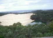
    Window Lakes such as Yankee Jack, Ocean Lake and Lake Wabby are formed when the ground drops below the natural water table. Lake Wabby is especially unique as it is formed by the damming effect of a sand blow blocking the waters of a natural spring. Wabby is close to the eastern beach side of the island and unlike the other lakes it supports several species of fish.

    Perched LakesPerched lakes such as Lake Bowarrady which is 120 meters above sea level are formed by rainwater being caught in saucer-shaped depressions with a hard impervious base of organic matter. Lake Boomanjin at approximately 190 hectares in total area and is the Australia’s largest perched lake. Other perched lakes on the island include Lake Birrabeen and the very popular Lake McKenzie.

    Barrage Lakes.
    The island also has several barrage lakes, formed when moving sand dunes block a watercourse, and 'window' lakes, formed when a depression exposes part of the regional water table. There are many sand blows that cause Barrage Lakes.


    Eli Creek
    Throughout the island there are fractures in the dunes and the water table is exposed in window lakes and springs which create freshwater streams in profusion. The largest and most attractive on the eastern shore is Eli Creek, which winds from many kilometres inland to the sea. This is where you will be able to float down Eli Creek where it carves its way across 75 mile beach to pour 120 million litres of fresh water a day into the sea. On one 30 kilometre stretch of surf beach 200 creeks run into the Pacific Ocean.


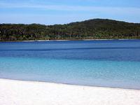
    Lake McKenzie
    Lake McKenzie, Lake Boemingen (reputedly the largest perched lake in the world), Ocean Lake, Hidden Lake, and Coomboo Lake. Each is notable for the clarity of the water, the purity of the white sands on the surrounding beaches and the peacefulness of the area. They are ideal places for picnics and fishing.

    Sand Blows
    The highest dunes on the island reach up to 240 metres above sea level. Forty perched dune lakes, half the number of such lakes in the world, can be found on the island. These lakes are formed when organic matter, such as leaves, bark and dead plants, gradually build up and harden in depressions created by the wind.